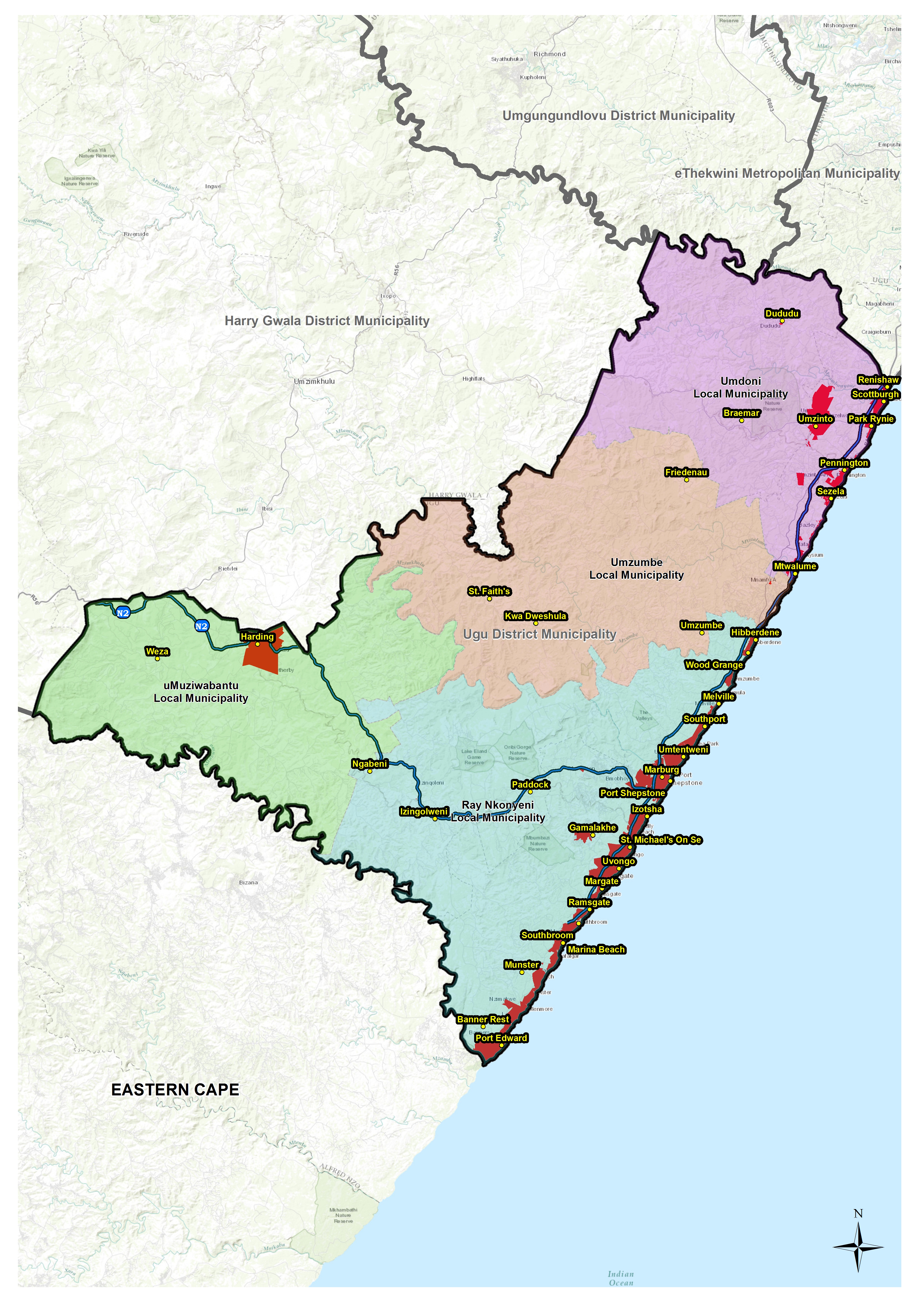
Ugu District Municipality is a category C municipality which is a municipality that has municipal executive and legislative authority in an area that includes more than one municipality. It is 4 908 km² in extent and boasts a spectacular coastline of 112 kilometres, which forms its Eastern border. The region is bordered on the North by the eThekwini, in the West by Umgungundlovu and Harry Gwala District municipalities and on the Southern side shares its borders with the Eastern Cape Province. The municipality consists of 85 municipal wards, which culminate into four local municipalities, namely Ray Nkonyeni, Umuziwabantu, Umzumbe and Umdoni. Ugu District municipality has forty (40) traditional council areas within its jurisdictional area.
According to the Stats SA Community Survey 2016, the total population of the Ugu District Municipality area of jurisdiction is 753 336 while the 2020 mid-year projections estimate a total population to be 824 612 in the year 2021, a growth rate of 2.03. The district has a relatively young population with the children and youth making up 38.7% of total population. The dominant population group is Africans making up 90% of the total population. Indians, Coloureds and Whites make up the other 10% of the population. The Ugu District Municipality area of jurisdiction has a total number of 175 146 households with an average size of four persons per household.

Vision and mission
Ugu's vision and mission statement which gives directives to what the municipality wants to achieve in terms of its medium and long term developmental goals.
By 2035 Ugu District Municipality will provide adequate access to basic services in an efficient and sustainable manner , enhancing the quality of its citizens in an inclusive progressive economy.
To ensure all our communities have access to quality drinking water, decent sanitation, sustainable economic opportunities underpinned by the active participation of our citizens in exemplary government.